Straight-In Update: Info Strip Gestures, Scroll Cues, and Selection Persistence
This update introduces gesture-controlled grab handle and swipe support to the airport info strip, visual scroll indicators for long approach lists, and persistence for selected instrument approaches. We have also corrected map rendering layers and resolved database issues with certain airport diagrams.
Info Strip UX Updates
- Gesture-Controlled Handle: Expansion and collapse of the airport info strip are now managed through a dedicated bottom-middle grab handle.
- Swipe Support: Pilots can perform vertical swipe gestures on the grab handle to smoothly expand or collapse the airport details sheet, preserving sliding animations.
- Cockpit Benefit: Allows quick, intuitive one-handed adjustment of the airport overlay using physical swipes, reducing the need for precise taps in turbulent conditions.
Scroll Indicator Cues
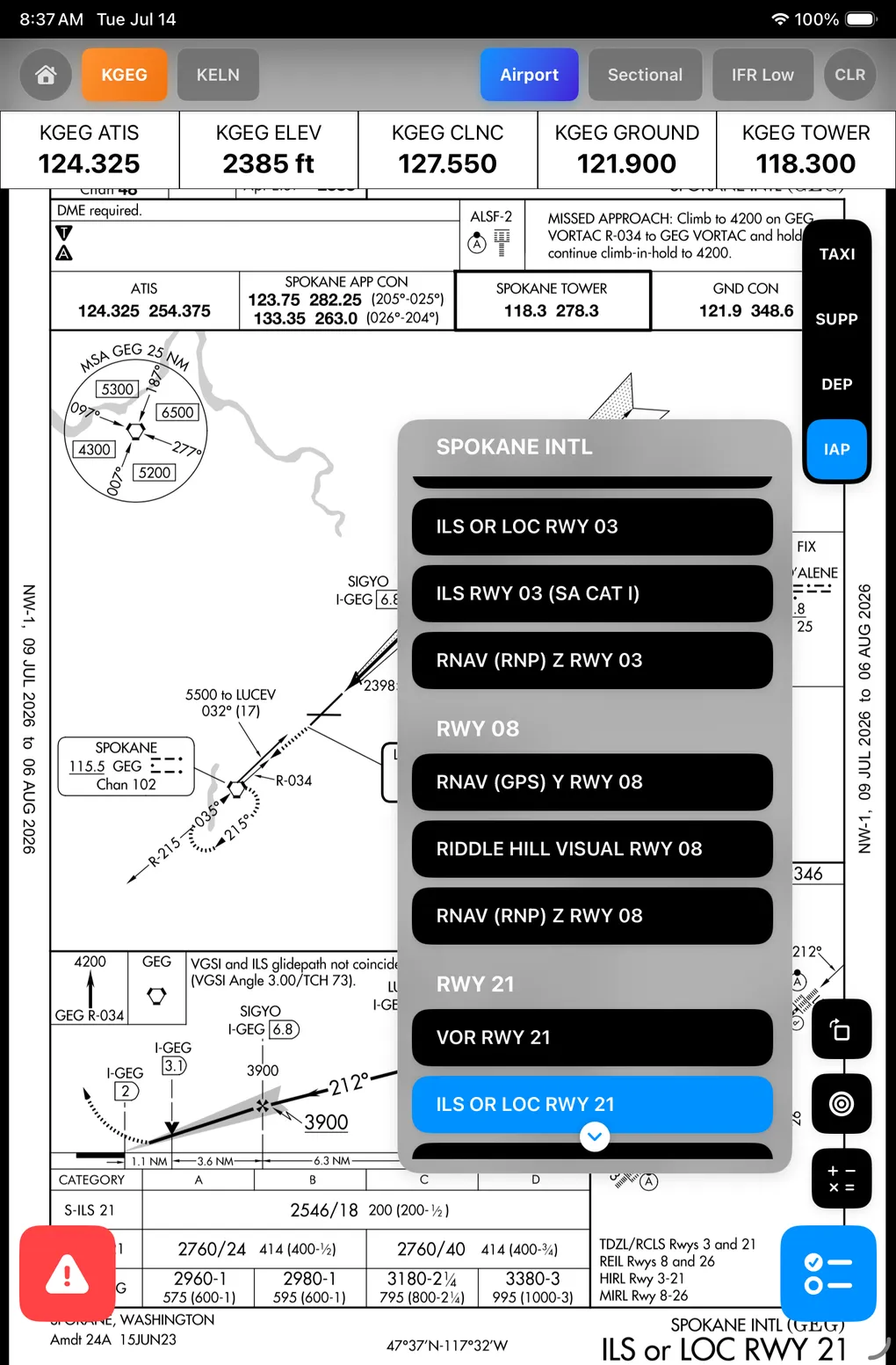
- Visual Scroll Cues: Added visual cues to long, scrollable menus such as the instrument approaches (IAP) list, signaling that more procedures are available below the screen edge.
- Dynamic Feedback: Indicators automatically disappear once the user scrolls to the bottom of the list or if the entire list fits within the view.
- Cockpit Benefit: Helps pilots immediately identify when an airport has more instrument approaches available, preventing missed options during high-workload phases.
IAP Selection Persistence
- State Preservation: Resolved an issue where toggling between airport tabs, viewing active selections, or switching details caused the active instrument approach selection to clear.
- Persistent Views: The selected approach chart remains active and displayed when navigating back and forth between airport tabs.
- Cockpit Benefit: Prevents losing the selected approach chart when navigating between airport information tabs, keeping critical plates instantly accessible without re-selection.
Map Tile Ordering Repairs
- Corrected Z-Index Layering: Fixed rendering order where Proximity Circles and Route paths were occasionally drawn underneath base map tiles and chart layers.
- Overlay Visibility: Navigation lines, routes, and proximity circles are now correctly rendered on top of the chart layer, ensuring they are always visible.
- Cockpit Benefit: Keeps essential navigation lines and safety proximity margins layered clearly on top of background maps and charts.
Backend Processing Repairs
- Airport Diagram Database Fixes: Repaired airport diagrams in the system database (such as KGEG) to ensure they generate and display correctly.
- Cockpit Benefit: Restores access to airport layouts and taxiway diagrams that were previously failing to load, ensuring complete ground navigation coverage.
